UN
6 Penmoor Place
£ 139,000
Description
We don't have a Description for this property.
- Bedrooms
- 3
- Bathrooms
- 0
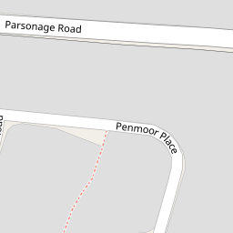


Leaflet © OpenStreetMap contributors
The heatmap indicates the level of crime in the area. The color of the heatmap indicates the crime severity and recency.
Metrics Year-on-Year
- Average area value
- 206,045.00 £Increased by 4.02 %
- Average area rental value
- 803.00 £/moIncreased by 3.61 %
- Est rental Yield
- 4.68 %Decreased by 0.21 %
- Crime Rate
- 21.00 %Unchanged by 0.00 %
from 198,091.00 £
from 775.00 £/mo
from 4.69 %
from 21.00 %
Nearby Schools
| Name | Type | Ofsted | Distance |
|---|---|---|---|
| Berrow Church Of England Primary School | Voluntary Controlled School | Requires improvement | 0.27 KM |
| Burnham-On-Sea Building | Children's Centre Linked Site | 3.36 KM | |
| St Andrew'S Church Of England Voluntary Controlled Junior School | Voluntary Controlled School | Good | 3.37 KM |
| Burnham-On-Sea Community Infant School | Community School | Outstanding | 3.41 KM |
| The King Alfred School An Academy | Academy Sponsor Led | 4.90 KM |
Images
Nearby Streets
| Name | Average Price | Average Sqft | Distance |
|---|---|---|---|
| Campoline Drive | £ 370,000 | 0 | 0.00 KM |
| Ash Tree Close | £ 0 | 0 | 0.00 KM |
| Patricia Close | £ 398,000 | 0 | 0.00 KM |
| Shelley Close | £ 0 | 0 | 0.00 KM |
| Mountbatten Close | £ 295,000 | 0 | 0.00 KM |
Nearby Transport
| Name | NLC | TLC | Distance |
|---|---|---|---|
| Highbridge And Burnham | 3314 | HIG | 6.40 KM |
| Weston-Super-Mare | 3391 | WSM | 9.66 KM |
Nearby Listings
| Address | Price | Type | Score | Distance |
|---|---|---|---|---|
| Barton Road, Berrow, Burnham-on-Sea, TA8 | £ 379,000 | BUY | Unknown | 0.10 KM |
| Church House Road, Berrow | £ 300,000 | BUY | 6 / 10 | 0.15 KM |
| Barton Road, Berrow, Burnham-on-Sea, Somerset, TA8 | £ 299,950 | BUY | 7 / 10 | 0.16 KM |
| Church House Road, Berrow | £ 300,000 | BUY | 6 / 10 | 0.16 KM |
| Penmoor Road, Berrow, Burnham-on-Sea, TA8 | £ 269,950 | BUY | 6 / 10 | 0.17 KM |
Nearby Properties
| Address | Price | Distance |
|---|---|---|
| 13 Penmoor Place | £ 5,500 | 0.00 KM |
| 7 Penmoor Place | £ 76,000 | 0.00 KM |
| 6 Penmoor Place | £ 139,000 | 0.00 KM |
| 9 Penmoor Place | £ 210,000 | 0.00 KM |
| 2 Penmoor Place | £ 160,000 | 0.02 KM |